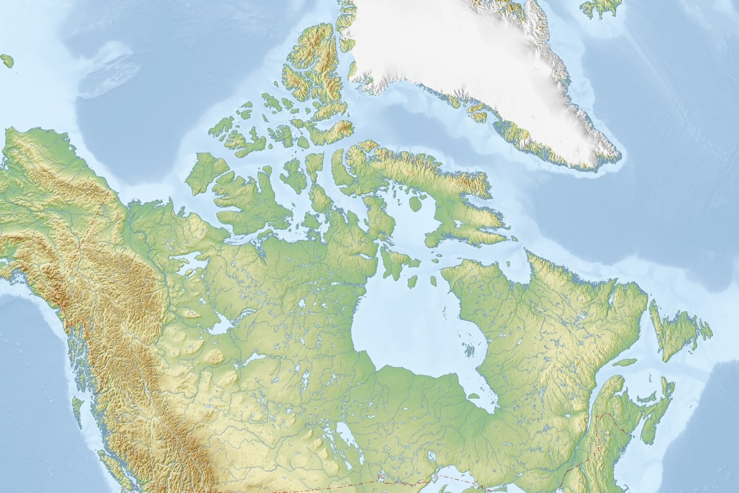


Canada’s vast and varied landscapes offer a treasure trove of geographical wonders. From the majestic Rocky Mountains to the expansive Great Plains, this quiz will test your knowledge of the physical features that define this beautiful country. Get ready to explore Canada’s topography and see how much you know about its natural landmarks. Good luck!
We recommend that you do not leave the page that you are taking this quiz in. Stay honest 🙂
Canada Physical Map Quiz Questions Overview
1. Which mountain range runs along the western coast of Canada?
Appalachian Mountains
Rocky Mountains
Coast Mountains
Laurentian Mountains
2. What is the largest lake entirely within Canada?
Great Bear Lake
Lake Superior
Lake Huron
Great Slave Lake
3. Which river is the longest in Canada?
Fraser River
Mackenzie River
St. Lawrence River
Yukon River
4. Which Canadian province is known for its extensive prairies?
Ontario
Quebec
Saskatchewan
Newfoundland and Labrador
5. What is the name of the large island located off the east coast of Canada?
Vancouver Island
Prince Edward Island
Baffin Island
Newfoundland
6. Which Canadian province is home to the Rocky Mountains?
Manitoba
Alberta
Nova Scotia
Prince Edward Island
7. What is the name of the bay that is the largest in Canada?
Hudson Bay
James Bay
Fundy Bay
Ungava Bay
8. Which Canadian territory is known for its tundra landscape?
Yukon
Northwest Territories
Nunavut
British Columbia
9. Which river forms part of the border between Canada and the United States?
Fraser River
Mackenzie River
St. Lawrence River
Niagara River
10. Which Canadian province is known for its rugged coastline and numerous fjords?
Nova Scotia
New Brunswick
British Columbia
Quebec
We recommend that you do not leave the page that you are taking this quiz in. Stay honest 🙂